My ride report for Banff through Butte (where I pulled out).
Click to launch presentation ---> 2011 TDR Richard Ridlehuber report
Features: scenery around Banff; Meet Crazy Larry; The start at YWCA; Riders: David Horton, Derek Bentley, Dale Shadley, Bob Anderson; the Stryker snow section; Holland Lake lodge; the treacherous road wash out near Ovando; Wickes Pass Dilemna; and my decision to withdraw due to injury. There is no sound track other than the video sections. Created in MS Powerpoint with 5 second slide transition. Good for family and friends or people new to the event. The GPS tracks shown at the beginning of each day are my own compared to the routes. I also show elevation profiles. There are no GPS mapping errors in the profiles - the climbs are as steep as they appear. Enjoy
June 19, 2011
June 06, 2011
Some last minutes facts and figures (for those who like numbers)
Richard's weight at Start - 210 lbs, 14% body fat (by impedance method)
Miles ridden since December 5, 2010 = 4038
Number of Bikepacking trips done for training = 5 (3 in the mtns, 2 on rolling terrain)
Max number of feet climbed on a loaded bike in 1 day = 9600/120 miles
Steepest grade ridden on loaded bike - 17% for 0.2 miles (Green River Cove road)
Number of bears seen = 0
Number of deers seen = plenty
Other critters seen = not many
Weight of bike and gear (without snow shoes) 49 lbs (I will send unneeded equipment home as I go)
The sun rise in the Northern parts of the course is 4:30 AM.
Sunset is 9:45 PM.
Avg night time temp is upper 20's to mid 30's on most of the course (due to elevation)
Miles ridden since December 5, 2010 = 4038
Number of Bikepacking trips done for training = 5 (3 in the mtns, 2 on rolling terrain)
Max number of feet climbed on a loaded bike in 1 day = 9600/120 miles
Steepest grade ridden on loaded bike - 17% for 0.2 miles (Green River Cove road)
Number of bears seen = 0
Number of deers seen = plenty
Other critters seen = not many
Weight of bike and gear (without snow shoes) 49 lbs (I will send unneeded equipment home as I go)
The sun rise in the Northern parts of the course is 4:30 AM.
Sunset is 9:45 PM.
Avg night time temp is upper 20's to mid 30's on most of the course (due to elevation)
May 29, 2011
Some Important links to Follow the 2011 Tour Divide
Here are the links to some of the key web pages about the 2011 Tour Divide:
Tour Divide web page - the main source of info. Lots of content here. I am in the start list for 2011 Grand depart. http://tourdivide.org/
Interactive map showing the route and elevation. I used this to make my plans. I am traveling North to South.
http://eatsleepridegreatdivide.com/#/
MTB Cast.com - the page with the audio call in reports: http://mtbcast.com/site2/
Facebook group: "Richard Ridlehuber can finish the Tour Divide by July 4th" Search it in Facebook and ask to be a member.
Link to a Beta version of a web page that displays: the route, weather, snowpack information, and rider location. It is not updated with the 2011 participants yet and doesn't display correctly on some computers. http://bluedot.mobi/td
NOAA Snowpack webpage: NOAA Snowpack data
There are record amounts of snow on the course this year. It is a huge factor. Those who decide to bypass it, forfeit there claims of doing the "official route". Those who choose to go through it, will be slower. I plan to go through it - I've got one chance to do this event and I don't want to compromise my results with a detour.
Tour Divide web page - the main source of info. Lots of content here. I am in the start list for 2011 Grand depart. http://tourdivide.org/
Interactive map showing the route and elevation. I used this to make my plans. I am traveling North to South.
http://eatsleepridegreatdivide.com/#/
MTB Cast.com - the page with the audio call in reports: http://mtbcast.com/site2/
Facebook group: "Richard Ridlehuber can finish the Tour Divide by July 4th" Search it in Facebook and ask to be a member.
Link to a Beta version of a web page that displays: the route, weather, snowpack information, and rider location. It is not updated with the 2011 participants yet and doesn't display correctly on some computers. http://bluedot.mobi/td
NOAA Snowpack webpage: NOAA Snowpack data
There are record amounts of snow on the course this year. It is a huge factor. Those who decide to bypass it, forfeit there claims of doing the "official route". Those who choose to go through it, will be slower. I plan to go through it - I've got one chance to do this event and I don't want to compromise my results with a detour.
May 17, 2011
The drone of the 13 year Chicada
April 28, 2011
How to climb Fern Gully
Climbing this short (50 yards) steep (25%) gully single track has become a challenge for local mtn bikers. In this video, I demonstrate how it is done. Keys to a successful climb are good traction (tires) and absence of leaves on the trail, correct gear selection, how fresh you are and a little bit of coordination. My success rate is about 50% climbed - depending on how the factors above combine.
How to climb Fern Gully
How to climb Fern Gully
April 19, 2011
2011 Tour Divide preparation report - April 19, 2011
April 19, 2011. I am ready. Equipment is selected and dialed in. I have logged 3000+ mile since December 5th and am in a maintain/hold pattern of fitness, teetering on the edge of loosing what I have and carving a peak too early. This past Sunday I rode 105 miles, two major climbs totaling 9000 feet in elevation gain and wanted to go longer, but ran out of time. My wife snatched me off the mountain and took me home. That was plan E for the weekend. Plans A,B,C and D got nixed due to killer tornadoes that ripped through the south, killing 41 people. One lesson I have learned - the hard way - about my outdoor adventures is you can't beat the weather - you must co-operate with it. Don't be a hero. More later...
The Route:

A few of pics from Sunday's ride:
The Route:

A few of pics from Sunday's ride:
 |
| Top of Caesars's Head - 7 miles avg grade = 6%, mile 75 into route |
 |
| Eastern Continental Divide on the back side of Caesars head, mile 78 into route. |
 |
| Cradle of Forestry, Pisgah National Forest mile 105 of my trip. |
March 21, 2011
TDR 3 Day Mountain Bikepack training ride - Solo (almost)
Training for the 2011 Tour Divide has become more of a solo endeavor. My training friend, 2010 TDR finisher Shawn Sheppard, has taken a new job in Virginia and moved away. I continue on, accompanied in sunny weather by my shadow, aka Dickey.
This weekend I needed to do 3 days and two nights in the mountains of SC/NC with a loaded bike to check out my bio-mechanical fitness (how well my knees will hold up) and soft tissue fitness and hygiene (ie saddle sore situation).
Link to video of --> Start report
My plan involved leaving from work in the late afternoon and riding to Saluda NC. Saluda is at the top of a major climb from the elevation in the upstate SC of 800 - 900 feet to the 1800 - 2000 foot level. Saluda is somewhat of a "Mayberry" town with its quaint shops and eateries. Most notable is the Purple Onion Cafe, which serves up a good pizza and has wonderful staff. After pizza dinner. I rode the final 4.5 miles to Orchard Lake campground and bivied under the stars to a huge full moon, listening to frogs and the sound of a nearby creek.
Saturday morning started before sun-up with a quick pack up of dew dampend equipment. My left knee had aggrivated me on the climb into Saluda and when it started again a mile out of the campground, I stopped and noticed my saddle had slid back and I was putting too much pressure on the top of the knee. I stopped and moved my saddle full forward, and continued on. The knee pain decreased. Lesson learned (again): mark saddle setback position with marking tape to detect saddle setback movement before knee pain starts.
Saturday's route traveled through gravel Green River Cove road, DuPont Forrest and Cascade Lakes road towards Brevard. Once in Brevard, the plan was to climb more gravel roads to Highway 215, then climb a 6 mile 6% avg grade paved climb to the Blue Ridge parkway and descend 25 miles back to Pisgah and bivy near the Pisgah Horse stables. At the entrance to Pisgah Forest, I was confronted with a huge flashing sign announcing FS 475 was closed due to a major wash out. Gravel trucks were running up and down the road, not a good sign for a guy on a 45 lb bike. After a quick stop at the closed Pisgah Ranger station, I rerouted and took FS 474 up to the Parkway, climbing steadily on gravel roads and Hway 276. The junction of 276 and the Parkway served as my rewarding milestone rest stop where I finished my SubWay sandwich in a swarm of flying things, while dark clouds loomed in the distance and the distant sound of thunder threatened. I put on my helmet cam and began the descent back towards Pisgah, only to get caught in the rain.
Link to video at Stop at Blue Ridge Parkway
Sunday started early. I needed to get back home to the wife and kids in Spartanburg, The good news was the weather was good: cool and overcast, but my fatigue level was higher and I missed the breakfast I needed because I started before the restaurants opened. Nothing like a Butterfinger Candy Bar for breakfast.
The road out of Brevard is nice. Little traffic, shouldered roads and gentle grade, My route had me taking a road through the area named Becky Mountain. The elevation profile showed Becky Mountain as a steep wall. I thought it was a GPS mapping error and ignored it as I planned the route. I was wrong.
When I turned off of 276 onto Becky Mountain Road it was an 8% 2 mile climbed, that I ended up having to dismount and push up. (I don't walk many climbs and can probably count the number of climbs I have walked in the past 15 years on one hand). I stayed positive and focused on the descent down the back side of the climb. It was worth it.
The next 50 miles consisted on re-tracing the same gravel roads I rode in on and dealing with the steady headwind back to Spartanburg. I finished the 200 mile trip with 13,000 feet of climbing by 3 PM.
Video of Finish report in Spartanburg
 |
| Dickey |
Link to video of --> Start report
My plan involved leaving from work in the late afternoon and riding to Saluda NC. Saluda is at the top of a major climb from the elevation in the upstate SC of 800 - 900 feet to the 1800 - 2000 foot level. Saluda is somewhat of a "Mayberry" town with its quaint shops and eateries. Most notable is the Purple Onion Cafe, which serves up a good pizza and has wonderful staff. After pizza dinner. I rode the final 4.5 miles to Orchard Lake campground and bivied under the stars to a huge full moon, listening to frogs and the sound of a nearby creek.
Saturday morning started before sun-up with a quick pack up of dew dampend equipment. My left knee had aggrivated me on the climb into Saluda and when it started again a mile out of the campground, I stopped and noticed my saddle had slid back and I was putting too much pressure on the top of the knee. I stopped and moved my saddle full forward, and continued on. The knee pain decreased. Lesson learned (again): mark saddle setback position with marking tape to detect saddle setback movement before knee pain starts.
Saturday's route traveled through gravel Green River Cove road, DuPont Forrest and Cascade Lakes road towards Brevard. Once in Brevard, the plan was to climb more gravel roads to Highway 215, then climb a 6 mile 6% avg grade paved climb to the Blue Ridge parkway and descend 25 miles back to Pisgah and bivy near the Pisgah Horse stables. At the entrance to Pisgah Forest, I was confronted with a huge flashing sign announcing FS 475 was closed due to a major wash out. Gravel trucks were running up and down the road, not a good sign for a guy on a 45 lb bike. After a quick stop at the closed Pisgah Ranger station, I rerouted and took FS 474 up to the Parkway, climbing steadily on gravel roads and Hway 276. The junction of 276 and the Parkway served as my rewarding milestone rest stop where I finished my SubWay sandwich in a swarm of flying things, while dark clouds loomed in the distance and the distant sound of thunder threatened. I put on my helmet cam and began the descent back towards Pisgah, only to get caught in the rain.
Link to video at Stop at Blue Ridge Parkway
 |
| Blue Ridge Parkway at junction with Hwy 276 |
 |
| Map location and elevation |
Sunday started early. I needed to get back home to the wife and kids in Spartanburg, The good news was the weather was good: cool and overcast, but my fatigue level was higher and I missed the breakfast I needed because I started before the restaurants opened. Nothing like a Butterfinger Candy Bar for breakfast.
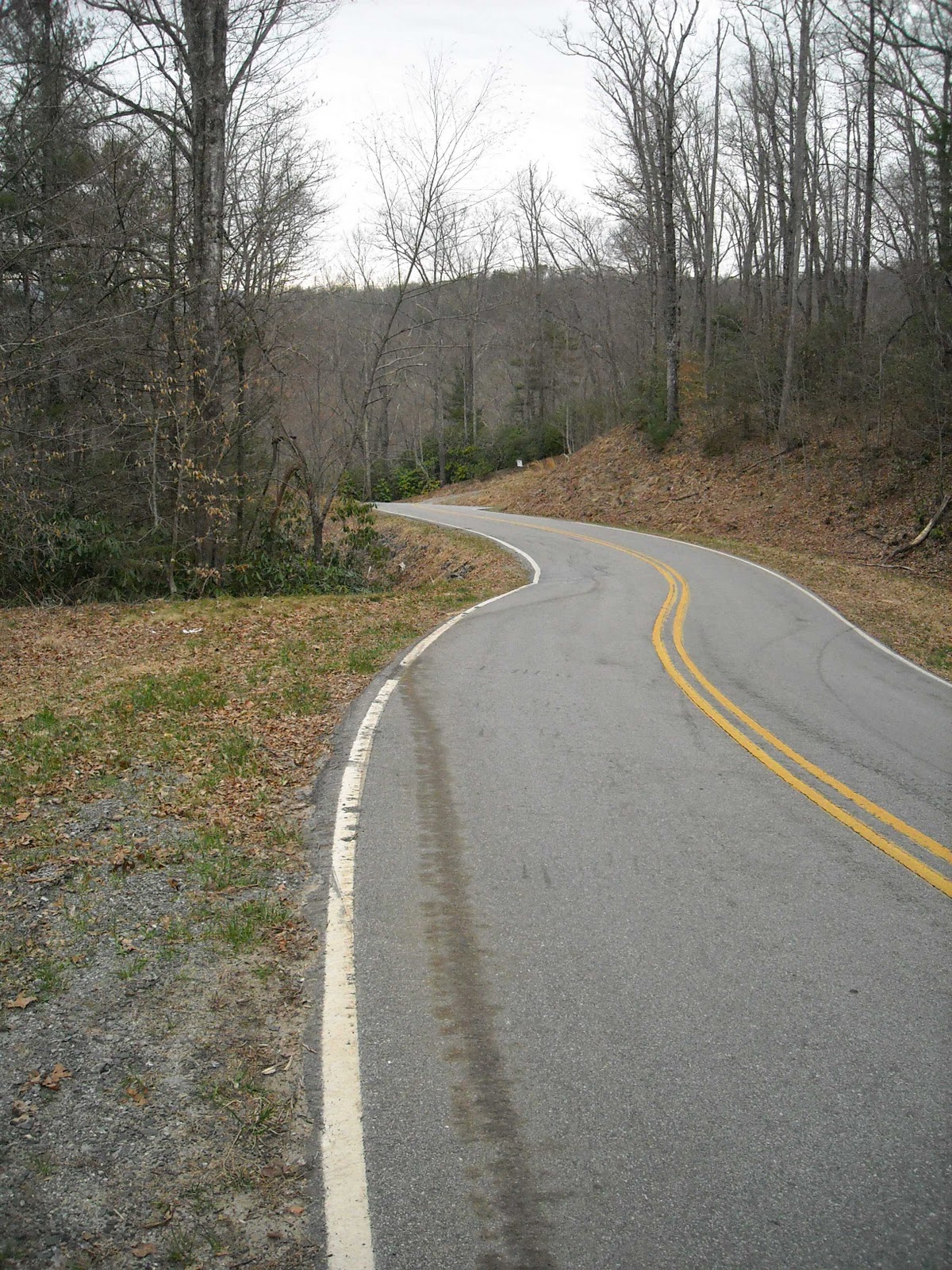
The road out of Brevard is nice. Little traffic, shouldered roads and gentle grade, My route had me taking a road through the area named Becky Mountain. The elevation profile showed Becky Mountain as a steep wall. I thought it was a GPS mapping error and ignored it as I planned the route. I was wrong.
 |
| Becky Mountain |
 |
| Becky Mountain |
The next 50 miles consisted on re-tracing the same gravel roads I rode in on and dealing with the steady headwind back to Spartanburg. I finished the 200 mile trip with 13,000 feet of climbing by 3 PM.
Video of Finish report in Spartanburg
March 06, 2011
The contents of the mysterious, heavy old suitcase REVEALED !!!
It was full of cold war era Popular Science Magazines !! My Dad always talked about playing buried treasure. I'm sure he had fun hiding this old suitcase.
 |
| This is what the dog saw. |


February 20, 2011
February 12, 2011

February 05, 2011
A Pinnacle Moment - 2007 Assault on Mt Mitchell by Tandem
 |
| 2007 Assault on Mt Mitchell RW Ridlehuber (Captain) and Will Ridlehuber (Stoker) |
January 21, 2011
Tour Divide!!!
On January 10th, I submitted my letter of intent to do the Tour Divide (www.tourdivide.org). This is the the most physically and mentally demanding event I have every attempted.
January 10th is also the day my father died. I know he would have demanded that I do it, so I am. I buried my mother on November 13. She would have supported me as well.
What has led me to this point in my life? Is it a mid life crisis? Am I a nut? Watched Forrest Gump too many times? Read too many Jon Krakaur novels? Not hardly.
I am simply a cyclist. The kind of person who loves to ride a bicycle. I never have stopped riding a bicycle since I started as a child. I just keep finding another aspect of the sport and new event, or something else to inspire my next ride. The decision to do the Tour Divide is influenced in part by: 1) 2010 finisher, friend and co-worker Shawn Sheppard; 2) I have logged more than 92,000 miles on bicycles during the past 30 years; 3) I believe that cycling is a life time sport for everyone - its just a matter of matching the right aspect of the sport to what fits your particular time in life. My decision takes into account my experience and a racer both on and off road, race official, coach (almost), event director, charity ride fund raiser, father, husband, son and brother.
2011 Tour Divide LOI
January 10th is also the day my father died. I know he would have demanded that I do it, so I am. I buried my mother on November 13. She would have supported me as well.
What has led me to this point in my life? Is it a mid life crisis? Am I a nut? Watched Forrest Gump too many times? Read too many Jon Krakaur novels? Not hardly.
I am simply a cyclist. The kind of person who loves to ride a bicycle. I never have stopped riding a bicycle since I started as a child. I just keep finding another aspect of the sport and new event, or something else to inspire my next ride. The decision to do the Tour Divide is influenced in part by: 1) 2010 finisher, friend and co-worker Shawn Sheppard; 2) I have logged more than 92,000 miles on bicycles during the past 30 years; 3) I believe that cycling is a life time sport for everyone - its just a matter of matching the right aspect of the sport to what fits your particular time in life. My decision takes into account my experience and a racer both on and off road, race official, coach (almost), event director, charity ride fund raiser, father, husband, son and brother.
2011 Tour Divide LOI
I have a goal to achieve, great people to meet, beautiful country to appreciate, equipment to prove, health to enjoy, and a dream to fulfill. Count me in at the start of 2011 Tour Divide race in Banff on June 10.
A very experienced cyclist and Tour Divide Rookie.
Richard W Ridlehuber
Spartanburg, SC
46 - married, father of 3.
January 15, 2011
My Dad's Obituary

(turn volume up all the way)
1) RBR Funeral - Beginning through Scripture readings
2) RWR Comments
3) Homily Part 1 Rev Tom Garman
4) Homily Part 2 Rev Tom Garman
5) Amazing Grace to end
RICHARD B. RIDLEHUBER
Richard Byrd “Dickey” Ridlehuber, 73, resident of 423 Willard Road, died January 10, 2011 at his home.
Born in Greenwood, February 13, 1937, he was a son of the late Ernest Owen Ridlehuber and Alma Wilson Ridlehuber. He was a graduate of Greenwood High School and Southern Technical Institute in Kennesaw, GA. Mr. Ridlehuber was the former owner/operator of Richard Ridlehuber Real Estate & Insurance.
He was of the Episcopal faith and was a member of the Greenwood Motorcycle Club and the BMW Motorcycle Owners Club of America.
Surviving are two sons, Richard Walter Ridlehuber and wife Janet Hollingsworth Ridlehuber of Spartanburg and Charles Brinson Ridlehuber and wife Gail Welsford Ridlehuber of Beaufort; a daughter, Page Brinson Fletcher and husband Matthew K. Fletcher of West Columbia; a brother, Ernest Owen “Buddy” Ridlehuber, Jr. and wife, Gertie Ridlehuber of Greenwood; and seven grandchildren. He was predeceased by a brother, Hugh Wilson Ridlehuber, MD of California.
Memorial services will be conducted at 11:00 am Monday at the Blyth Funeral Home Chapel with Rev. Tom Garman officiating.
The family will be at their respective homes and will receive friends at the funeral home from 10 to 11 Monday morning.
In lieu of flowers memorials may be made to the charity of one’s choice.
January 13, 2011
2005 deRonde van Vlaanderen (Tour of Flanders - Belgium)
The Tour of Flanders is one of the toughest single day cycling road races in the world. In my opinion it is the toughest - tougher than Paris Roubaix because the cobbles are climbed (Paris Roubaix is flat). The event is 165miles long with the first 100 miles pancake flat, then the famous cobbled hills (bergs) of Flanders start. Each one is short, about 1 Km or less, but very steep with grades of 20-25% in some places. In years when is rains, the course is almost un-ridable. The number of climbs varies, but is between 15-20. The course changes slightly each year.
Every year the Pro's race on Sunday, however the Saturday before, the course is open to cyclo-tourists. Each year 10-15,000 cyclist tackle a version of the course. The ultimate test is to ride full distance that the Pro's do. In 2005, I was one of a hand full of Americans to complete the full course, thanks to the support of my co-corkers on "Team Milliken". The photo video below chronicles the entire trip, including a few surprises. Enjoy.
January 06, 2011
King Thomas Hill Climb at dusk while a dog attacks
Click the link and turn the volume up all the way ---> King Thomas Hill Climb at dusk while a dog attacks
Bike49 Crew spends Christmas in Spartanburg
3 weeks before Christmas I got an e-mail from my brother. He wanted me to know that 4 cyclists were riding around the 49 contiguous United States and were headed our way. They may want a place to stay. So I sent an e-mail to the web page address on http://www.bike49.org/ and heard from Sara: They are going through Spartanburg over Christmas and appreciate the offer for some floor space. Having lost my mother a month before, this Christmas was going to be first without her. The Bike 49 crew filled in the emptiness and it turned out to be a most memorable Christmas. The photo below was taken as we rolled out of Spartanburg in snow and ice headed towards Columbia, SC on Dec 26.
GodSpeed Bike49rs !! and thanks for a Merry Christmas.

GodSpeed Bike49rs !! and thanks for a Merry Christmas.

Ridlehuber Reels em in
Check out footage of me reeeling in some friends on a Sunday afternoon group ride.
Click here ---> Ridlehuber reels em in
Click here ---> Ridlehuber reels em in
November 07, 2010
Who says Southerners can't climb!!!!
I think we have some of the best cycling and climbs right in our back yard of the Upstate SC. No matter how you measure the difficulty of a climb, a strong climber in the Southeast is competitive anywhere in the world. I analyzed some local climbs and compared them to climbs known and revered elsewhere. The simple metric that best represents difficulty is grade and length.(Feet climbed per mile) Click the linked table below to open it in a larger window and see how the climbs rate.
Southeastern Climb data with Feits Index comparison
Southeastern Climb data with Feits Index comparison
July 03, 2005
Share The Road Safe Cycling Tips for Cyclists by a Cyclist
Cycling is an inherently dangerous sport. The accident rate for cyclists is one of the highest. But practicing a few safety tips will make your ride safe and enjoyable for you and your riding partners for years to come.
General Tips
1) Wear a helmet. Make sure it fits correctly. If you aren’t sure about the fit, go to a local bike shop and have them check it for you.
2) Wear brightly colored clothes. Yellow, red, orange are colors that are most easily recognized.
3) Obey all traffic rules. Cyclist have the same rights and responsibilities as motorists. This means stopping at stop signs, red lights and yielding.
4) If you come upon a traffic light that is tripped by a sensor and you can’t trip the sensor, treat the light like a stop sign and wait until it is safe to cross or until a car comes that can trip the sensor.
5) Ride on the right side of the road with the flow of traffic. Do not cross the center line.
6) Use the standard hand signals for turning right and left and stopping/slowing.
7) Do not ride at times of heavy traffic such as between 7:00 AM – 9:00 AM in the mornings, 3-4 and 5-6 in the afternoons on weekdays.
8) Plan your ride times and routes so as to minimize traffic, especially if you commute.
9) Avoid riding on Friday evenings.
10) Make sure you or someone in the group has a spare tube and pump or CO2 cartridge.
11) Carry a cell phone.
12) Carry some change or small amount of money just in case you need to call home.
13) Make sure you have some sort of identification on your person or in your bike bag. Make sure it lists your blood type, Dr’s phone number and emergency contact info.
14) If you get harassed by a motorist, pedestrian, or anyone, do your best to ignore it and get out of there as quickly as possible. You don’t know why that person harassed you, what they may be under the influence of, when they got out of jail, whose car they stole, or what kind of gun they are carrying …
15) Keep your equipment in good condition. No one likes to ride with someone who can’t keep their bike going. Overhaul your bike at least once per year or have a local bike shop do it for you. Replace worn tires. Replace handlebars once every 2-3 years.
16) Let someone know where you will be riding and what time you expect to be back.
17) Get certified by the American Red Cross to administer First Aid and CPR. Keep a first aid kit in your car.
18) Be an ambassador of kindness. Acknowledge (smile, speak, nod) people that you see out in their yards etc… especially on routes that you ride often. The people that live along the route will get to know you and identify with you as being an enjoyable part of their community rather than a nuisance.
Etiquette when riding with others
1) Ride predictably, in a straight line. Pay attention, look ahead, even if you are talking to someone.
2) Keep both hands on the handlebars. If you need to drink, eat, or take a hand(s) off the bars, drop back to the back of the group, or ride off the front.
3) If you are leading, point to road obstructions and ride around them. Announce the obstacle by yelling “HOLE”, “ROADKILL”, “ICE”, “SAND”, “ROCKS”, “GRAVEL” etc… to ensure riders are aware of the obstacle. Don’t try to bunny hop an obstacle.
4) Announce oncoming cars by yelling “CAR-UP”; announce cars approaching from the rear by yelling “CAR-BACK”.
5) Don’t make sudden movements to the side, don’t “halfwheel” or overlap wheels with the rider in front of you.
6) Ride two abreast at most and single file on busy roads.
7) If you run off the road, wait until the group passes before trying to get back on the road.
8) If you are following and can’t see around the rider in front of you, keep in mind that the person in front of you doesn’t want to ruin their expensive equipment by running through holes etc… and if you follow their wheel, chances are you won’t run into anything.
9) When the group stops at an intersection or road, look both ways and announce what is coming. Call out “CLEAR” if there is no traffic approaching. Call out: “TRAFFIC RIGHT” or “TRAFFIC LEFT” if a vehicle is approaching. Avoid saying CAR because CAR sounds too much like CLEAR.
10) If there is a new rider or someone unfamiliar with the course, appoint someone to stay with them to ensure they don’t get lost.
11) Take the time to get to know each other and if there are any medical conditions that could change the outcome of the day.
12) If you or someone in the group has to stop to fix a flat etc…, get completely off the road.
General Tips
1) Wear a helmet. Make sure it fits correctly. If you aren’t sure about the fit, go to a local bike shop and have them check it for you.
2) Wear brightly colored clothes. Yellow, red, orange are colors that are most easily recognized.
3) Obey all traffic rules. Cyclist have the same rights and responsibilities as motorists. This means stopping at stop signs, red lights and yielding.
4) If you come upon a traffic light that is tripped by a sensor and you can’t trip the sensor, treat the light like a stop sign and wait until it is safe to cross or until a car comes that can trip the sensor.
5) Ride on the right side of the road with the flow of traffic. Do not cross the center line.
6) Use the standard hand signals for turning right and left and stopping/slowing.
7) Do not ride at times of heavy traffic such as between 7:00 AM – 9:00 AM in the mornings, 3-4 and 5-6 in the afternoons on weekdays.
8) Plan your ride times and routes so as to minimize traffic, especially if you commute.
9) Avoid riding on Friday evenings.
10) Make sure you or someone in the group has a spare tube and pump or CO2 cartridge.
11) Carry a cell phone.
12) Carry some change or small amount of money just in case you need to call home.
13) Make sure you have some sort of identification on your person or in your bike bag. Make sure it lists your blood type, Dr’s phone number and emergency contact info.
14) If you get harassed by a motorist, pedestrian, or anyone, do your best to ignore it and get out of there as quickly as possible. You don’t know why that person harassed you, what they may be under the influence of, when they got out of jail, whose car they stole, or what kind of gun they are carrying …
15) Keep your equipment in good condition. No one likes to ride with someone who can’t keep their bike going. Overhaul your bike at least once per year or have a local bike shop do it for you. Replace worn tires. Replace handlebars once every 2-3 years.
16) Let someone know where you will be riding and what time you expect to be back.
17) Get certified by the American Red Cross to administer First Aid and CPR. Keep a first aid kit in your car.
18) Be an ambassador of kindness. Acknowledge (smile, speak, nod) people that you see out in their yards etc… especially on routes that you ride often. The people that live along the route will get to know you and identify with you as being an enjoyable part of their community rather than a nuisance.
Etiquette when riding with others
1) Ride predictably, in a straight line. Pay attention, look ahead, even if you are talking to someone.
2) Keep both hands on the handlebars. If you need to drink, eat, or take a hand(s) off the bars, drop back to the back of the group, or ride off the front.
3) If you are leading, point to road obstructions and ride around them. Announce the obstacle by yelling “HOLE”, “ROADKILL”, “ICE”, “SAND”, “ROCKS”, “GRAVEL” etc… to ensure riders are aware of the obstacle. Don’t try to bunny hop an obstacle.
4) Announce oncoming cars by yelling “CAR-UP”; announce cars approaching from the rear by yelling “CAR-BACK”.
5) Don’t make sudden movements to the side, don’t “halfwheel” or overlap wheels with the rider in front of you.
6) Ride two abreast at most and single file on busy roads.
7) If you run off the road, wait until the group passes before trying to get back on the road.
8) If you are following and can’t see around the rider in front of you, keep in mind that the person in front of you doesn’t want to ruin their expensive equipment by running through holes etc… and if you follow their wheel, chances are you won’t run into anything.
9) When the group stops at an intersection or road, look both ways and announce what is coming. Call out “CLEAR” if there is no traffic approaching. Call out: “TRAFFIC RIGHT” or “TRAFFIC LEFT” if a vehicle is approaching. Avoid saying CAR because CAR sounds too much like CLEAR.
10) If there is a new rider or someone unfamiliar with the course, appoint someone to stay with them to ensure they don’t get lost.
11) Take the time to get to know each other and if there are any medical conditions that could change the outcome of the day.
12) If you or someone in the group has to stop to fix a flat etc…, get completely off the road.
March 23, 2004
Adventure Racing: Lessons in Courage
The 2003 - 30 hour North Georgia Adventure Race
The Mole
5:00 AM Sitting on the tailgate of my truck, the thermometer is reading -5 F. A mole scurries under my feet seeking the warmth of the propane heater. Thomas arrives with the maps and instructions and we begin the ritual of deciphering the clues and UTM ordinates. The ink pens we normally use to write on the USGS maps with are frozen and will not write. We use Sharpies instead. 50 minutes later we mount our bikes, wearing all of our race clothing. Thomas reminds us to keep our heads on our shoulders. I add we also need to keep our hearts in our chests. We ride out into the frigid darkness, leaving the mole with the heater and Thomas with the other 84 support crews. I have NEVER ridden in such harsh conditions. The roads are covered in snow and ice and the wind-chill makes it feel like -20 F.
Us
Four months of mental focusing, planning, reserving cabins, testing equipment and physical preparations are united in this ambitious effort. None of us have completed a 24-hour adventure race, though we all have race resumes that hint we can. Our goal is to finish. The objectives are to have a good team experience and stay safe. The strategy is to minimize navigation errors, eat and drink little and often so as to keep kidneys going and hunger at bay. I estimate we will burn 1000 calories per hour, over 22,000 calories for the race. There is no way we can eat enough to keep up with the deficit, so we must rely on our reserves. Team Adventure Carolinas is: Drew Wilson, Tim LaRose and myself. Thomas DeMaria is the one-man support crew.
Checkpoint 1
The map says we turn right out of the Woody Gap School parking lot, go past the lake on our left and turn right at the Ranger Station. The road is icy and we pedal at a controlled pace favoring the snowy portions of the road for traction. We arrive at the right hand turn, pause and take it, but don't recognize the ranger station. We turn around and go back, just to be sure. Making a navigation error this early in the race would be embarrassing. We decide we are on the right course and continue along the road confirming our route by the names of the side roads and the creek names on the maps. Mountain Bike starts in adventure races are notorious for having a brutal climb at the beginning to thin things out a bit and this race is no different. We settle into a steady climbing pace, not breathing the frigid air too deep and warming the muscles slowly. My camel back tube is already frozen solid, I check my Polar water bottles. The nozzles are frozen and I don't want to break a tooth biting it open. I try to unscrew the top, but it's frozen. I jam the bottle in my jacket to warm the top and press on. I intended to drink every 10-15 minutes and eat Power Gels every half hour to maintain hydration and energy. I'm already behind that schedule. The road continues up.
We are mixing in and out of other teams who are stopping to adjust clothing, un-stick frozen derailleurs, hook up tow systems etc… We turn left and begin a descent down a very slippery snow covered gravel road. The 25 lb pack makes me top heavy and I unclip to descend with one foot out of the pedals for stability. A cyclist on another team just in front of me hits an icy patch and goes down, then Drew does the same thing. They slide off the road, but get back up and continue. They have so much clothing on that the falls don't hurt. After about a mile of descending we reach the manned checkpoint, sign in, turn around and ride back up the slippery road we just descended. We are in about 20th place.
The Wonder from Down Under
We continue along the snow covered gravel road, making good progress, traveling with several other teams, until we make the left hand turn onto the un-traveled, un-improved road that goes straight up the side of the next mountain. We dismount and start briskly walking up the road; Tim tries to ride it, but doesn't get very far and dismounts. We stop for Drew to make some clothing adjustments. The side zipper on his pants breaks and he is trying to repair it. Drew is not happy and getting more frustrated by the second. Tim and I look at each other and suggest that he take the pants off and worry about fixing the zipper later. He does and we move on. A little further, the road turns into a trail that soon disappears. Footprints are going in all directions indicating that other teams are confused. We stop, read the map take a compass bearing, and continue in a general direction. After a mile or two of this we find Checkpoint 2 on the trail. We punch the passport and continue only to encounter a woman running up the mountain we are descending. We think this is a little strange and wonder who she could be and why she is alone. Then we encounter a guy doing the same thing. We tell him about what we just saw and he says she is his teammate. We wonder who she is, because there are not that many women who can run like that in these conditions.
No 69
Checkpoint 3 is land marked by a church at the junction of FS 69 and FS 69C. The race instructions were very specific about NOT approaching checkpoint 2 on road 69; we must be on road 69C. Thomas and I made a special note of it by writing NO 69 in big red letters on the map. The next few miles are a navigation test. The roads and trails are overgrown, and the route is not clear. Teams scatter in all directions. I read the map, take a compass bearing and we head down an old logging roadbed that parallels a stream. We pop out on a road that shows on the map. The road is 69C, just where we need to be. The next couple of miles are fairly easy. We see the trout rearing station on the map and arrive at checkpoint 3 on road 69C. The checkpoint is womanned by three volunteers in their 20-30's busy building a fire out of wet wood. I ask: "Are you Girl Scouts?" They all stop, look directly at me and say, in unison "NO!"
10:52 AM We move on towards checkpoint 4.
"Read the map and use the compass."
The rest of the checkpoints all appear to be on roads. The navigation challenge is not as rigorous, but the unrelenting climbing is beginning to take its toll. Drew has a flat rear tire. We stop once to re-fill it with CO2, but it doesn't hold, so we have to stop again and replace the tube. Then I make our first navigation error by passing a landmark for checkpoint 4. Two miles later we arrive at a major gap where the Appalacian trail leads to Springer Mtn Ga and realize what we have done. We humbly turn around and ride back down the road only to find about 10 other teams congregating at the checkpoint. It has been placed 300 yards off the road up a hill. I trot up the hill to get the checkpoint. Several other teams have made the same mistake and a guy asks me how we are supposed to find these things? The answer, of course, is: "read the map and use the compass", but I don't say anything. Drew and Tim rest and refuel. Now I'm ticked because of the error and we set off at a brisk pace attempting to recover the 50 minutes lost. It could have been worse.
We ride more gravel roads, being more careful with navigation. The team with the Wonder Woman passes us. She is riding a Moots Mtn Bike and the guy has on a Salomon jacket. She has an Austrailian/NewZealand Accent. I dub her the "Wonder from Down Under" and we have a brief conversation about the tenacity of the Aussies and New Zealanders.
1:30 PM We arrive at CP5 to find two guys around a fire with plenty of bottled water. We are out of fluids. I drink three bottles and stuff two more in my pack. Drew recognizes one of the race volunteers and he tells us the paddling leg has been canceled because the lake froze and that half of the teams have dropped out of the race already. I'm relieved to know we won't have to paddle, but am not sure what the high attrition rate means. Is it the quality of the field? The conditions? The race? Or all of the above? Does it really matter?
Little-Big-Man
5:23 PM Thomas DeMaria is 5 feet 4 inches tall. He is a giant of a person. The world would be a much better place if there were more Thomas DeMaria's. When we pull into checkpoint 6/Transition area 1 at 5 PM in 17th place Thomas has a full meal, hot liquids, a fire, and our equipment laid out for us. He also befriended a family of 5 that look like LL Bean models and taught them how to support their two-man team. The LL Bean models, in turn, help Thomas by helping us. This is a definite, much appreciated, and totally unexpected high point and is just one of many examples of the terrific spirit and cooperation of the Adventure Racing Community.
It is getting dark quickly and the hiking leg starts with a pontoon ferry ride across the frozen headwaters of Lake Blue Ridge. After changing into dry clothes, Thomas briefs me on the hiking portion and makes the point that we should stay near the ridgelines. The hiking looks to be mostly on established trails and forest service roads. With the expected full moon reflecting off the snow I anticipate good night trekking conditions. We are carrying Petzyl headlamps capable of burning 30 hours continuously and plan to leave them on the whole time.
Journey Into the Darkness
6:33 PM We leave Thomas and the LL Bean Family models and walk off into the darkness. The race director has managed to get one of the local fire and rescue groups to bring a pontoon boat up the frozen lake to ferry the teams across the 100-yard wide lake. The ferrymen have their routine down and give us very specific instructions. We are to stand on the bow of the boat outside the railing so as to weight the front down to better break through the ice. I get in the middle. The boat driver does a three-point turn and we run up on the far side bank. The bowman tells me that I am first off and to wait until the wave surge is over and he will tell me when to jump. I do just as instructed and land safely on the other side. Drew and Tim make it without incident. We walk down the river bank to a trail head that leads up to Wilscot, a place we had just passed on Mtn Bikes. We meet two teams, one is studying their maps and trying to read the terrain. I ask them if they recognize the area from the Mtn Bike section and they say “Oh yeah” and then walk off about 50 yards or so to see what we do. I read the map, see the trail and we start walking. The other team follows, eventually passing us. I wonder how much I helped them out.
The moon is not rising. We can see the light from towns in the distance, but see no stars. I hope that the moonrise is late. We walk the trail, emblazoned with white triangles and end up at the top of a mountain to find Checkpoint 11 at the foot of a fire tower.
8:23 PM We speak briefly to the couple manning the checkpoint and continue down the road leading to the fire tower looking for a trail showing on the map. When we reach the point where the trail starts, an emergency service vehicle drives up and tells us the road we are on takes us to the gap where the trail ends. I confirm the suggestion by taking a compass bearing and we thank the men in the truck and make good time walking the road. The road ends at a trailhead and we start walking a trial that follows the ridgeline. Still no moon; it is getting colder (dropping below 20F) and the wind is starting to blow. I am eating and drinking constantly, stopping regularly. We aren't talking much, just putting one foot in front of the other and moving at a steady pace. We start looking for checkpoint 12 and do not see it where Thomas and I plotted it 14 hours ago. We arrive at a gravel road that is clearly marked on the map and walk down the road following some foot prints in search of the CP. We don't see it and turn around thinking it must be on the trail ahead. We walk ¼ mile up the trail, far enough to read the terrain and decide to re-plot the point. We confirm that the CP is back down the gravel road. Tim takes off for the CP, Drew and I follow, but at a more reserved pace. When we get back to the road, Tim is nowhere in site. Drew and I walk down the road and find the checkpoint, but do not see Tim. We begin calling and flashing our lights and end up announcing the checkpoint location to three other teams we passed earlier. Finally Tim arrives, he blew right by it, we punch the passport and start back up the trail. We quickly pass the three teams back and move on.
12:49 AM We reach Skeenah gap road and cross it, heading straight up a 1000 foot, steep climb. It is snowing; the winds are gusting to 25-30 mph through the trees. The trees are creaking and sound like sheep bleating or a chorus of women whispering. It is very eerie. My eyes start playing tricks on me as shadows from my headlight start to form images. I see a Volkswagen, then a refrigerator, and people who aren't there. Drew makes a comment about the sounds. We stop and catch our breath and assess the situation. Three teams pass us moving quickly in the opposite direction. I ask them what's up? And they say they are going back. Images of the Blair Witch Project come to mind. Drew has been hobbling for the past 3 hours and Tim said he doesn't feel good and has been eating Ibuprofen like candy. We look at the map and see how far we have to go: 12 more miles by foot, then another 16 by Mtn bike. We have been going for 22 hours. At the pace we are moving we will not make the time cutoffs. The options are to continue and risk injury or go back down to Skeenah Gap and have Thomas pick us up. This is not a time for glory.
1:57 AM I consider the situation and announce that I can't go on and offer to let Tim and Drew continue. They assert that we are a team and agree to go back down to Skeenah Gap. We pull out the race radio, put it together, and I announce who, and where we are, and that we are stopping at Skeenah Gap. They acknowledge us, and say that our support crew will meet us at Skeenah Gap. No sooner had we arrived at the Gap and Thomas drives up. We cram into the Blazer and stay around to offer assistance to two other teams who have made the same decision. On the drive back to the cabin, Tim sleeps and Thomas, Drew and I have a mini group therapy session. Thomas tells us how fortunate we are to have gone so far.
Post Race
We get back to the cabin, sleep 3-4 hours, pack up and drive down to the Woody Gap School to drop off the GPS and race radio. Only 8 of the 84 teams completed the full course in the 30-hour time limit. A handful of others trickled in on shortened courses. Remarkably there are no major injuries. An article in the Atlanta Journal Constitution reports that one person was treated for mild hypothermia, and one person complained of chest pains but checked out Okay at a local hospital. The teams who finished within the time limits were professional level teams or Army Rangers based at Camp Merryl near Suches.
We ended up “stopping” in 33rd place, in the top half of the field. We stuck to our strategy and objectives, but didn't meet our goal.
There will be other races and we are stronger.
The Mole
5:00 AM Sitting on the tailgate of my truck, the thermometer is reading -5 F. A mole scurries under my feet seeking the warmth of the propane heater. Thomas arrives with the maps and instructions and we begin the ritual of deciphering the clues and UTM ordinates. The ink pens we normally use to write on the USGS maps with are frozen and will not write. We use Sharpies instead. 50 minutes later we mount our bikes, wearing all of our race clothing. Thomas reminds us to keep our heads on our shoulders. I add we also need to keep our hearts in our chests. We ride out into the frigid darkness, leaving the mole with the heater and Thomas with the other 84 support crews. I have NEVER ridden in such harsh conditions. The roads are covered in snow and ice and the wind-chill makes it feel like -20 F.
Us
Four months of mental focusing, planning, reserving cabins, testing equipment and physical preparations are united in this ambitious effort. None of us have completed a 24-hour adventure race, though we all have race resumes that hint we can. Our goal is to finish. The objectives are to have a good team experience and stay safe. The strategy is to minimize navigation errors, eat and drink little and often so as to keep kidneys going and hunger at bay. I estimate we will burn 1000 calories per hour, over 22,000 calories for the race. There is no way we can eat enough to keep up with the deficit, so we must rely on our reserves. Team Adventure Carolinas is: Drew Wilson, Tim LaRose and myself. Thomas DeMaria is the one-man support crew.
Checkpoint 1
The map says we turn right out of the Woody Gap School parking lot, go past the lake on our left and turn right at the Ranger Station. The road is icy and we pedal at a controlled pace favoring the snowy portions of the road for traction. We arrive at the right hand turn, pause and take it, but don't recognize the ranger station. We turn around and go back, just to be sure. Making a navigation error this early in the race would be embarrassing. We decide we are on the right course and continue along the road confirming our route by the names of the side roads and the creek names on the maps. Mountain Bike starts in adventure races are notorious for having a brutal climb at the beginning to thin things out a bit and this race is no different. We settle into a steady climbing pace, not breathing the frigid air too deep and warming the muscles slowly. My camel back tube is already frozen solid, I check my Polar water bottles. The nozzles are frozen and I don't want to break a tooth biting it open. I try to unscrew the top, but it's frozen. I jam the bottle in my jacket to warm the top and press on. I intended to drink every 10-15 minutes and eat Power Gels every half hour to maintain hydration and energy. I'm already behind that schedule. The road continues up.
We are mixing in and out of other teams who are stopping to adjust clothing, un-stick frozen derailleurs, hook up tow systems etc… We turn left and begin a descent down a very slippery snow covered gravel road. The 25 lb pack makes me top heavy and I unclip to descend with one foot out of the pedals for stability. A cyclist on another team just in front of me hits an icy patch and goes down, then Drew does the same thing. They slide off the road, but get back up and continue. They have so much clothing on that the falls don't hurt. After about a mile of descending we reach the manned checkpoint, sign in, turn around and ride back up the slippery road we just descended. We are in about 20th place.
The Wonder from Down Under
We continue along the snow covered gravel road, making good progress, traveling with several other teams, until we make the left hand turn onto the un-traveled, un-improved road that goes straight up the side of the next mountain. We dismount and start briskly walking up the road; Tim tries to ride it, but doesn't get very far and dismounts. We stop for Drew to make some clothing adjustments. The side zipper on his pants breaks and he is trying to repair it. Drew is not happy and getting more frustrated by the second. Tim and I look at each other and suggest that he take the pants off and worry about fixing the zipper later. He does and we move on. A little further, the road turns into a trail that soon disappears. Footprints are going in all directions indicating that other teams are confused. We stop, read the map take a compass bearing, and continue in a general direction. After a mile or two of this we find Checkpoint 2 on the trail. We punch the passport and continue only to encounter a woman running up the mountain we are descending. We think this is a little strange and wonder who she could be and why she is alone. Then we encounter a guy doing the same thing. We tell him about what we just saw and he says she is his teammate. We wonder who she is, because there are not that many women who can run like that in these conditions.
No 69
Checkpoint 3 is land marked by a church at the junction of FS 69 and FS 69C. The race instructions were very specific about NOT approaching checkpoint 2 on road 69; we must be on road 69C. Thomas and I made a special note of it by writing NO 69 in big red letters on the map. The next few miles are a navigation test. The roads and trails are overgrown, and the route is not clear. Teams scatter in all directions. I read the map, take a compass bearing and we head down an old logging roadbed that parallels a stream. We pop out on a road that shows on the map. The road is 69C, just where we need to be. The next couple of miles are fairly easy. We see the trout rearing station on the map and arrive at checkpoint 3 on road 69C. The checkpoint is womanned by three volunteers in their 20-30's busy building a fire out of wet wood. I ask: "Are you Girl Scouts?" They all stop, look directly at me and say, in unison "NO!"
10:52 AM We move on towards checkpoint 4.
"Read the map and use the compass."
The rest of the checkpoints all appear to be on roads. The navigation challenge is not as rigorous, but the unrelenting climbing is beginning to take its toll. Drew has a flat rear tire. We stop once to re-fill it with CO2, but it doesn't hold, so we have to stop again and replace the tube. Then I make our first navigation error by passing a landmark for checkpoint 4. Two miles later we arrive at a major gap where the Appalacian trail leads to Springer Mtn Ga and realize what we have done. We humbly turn around and ride back down the road only to find about 10 other teams congregating at the checkpoint. It has been placed 300 yards off the road up a hill. I trot up the hill to get the checkpoint. Several other teams have made the same mistake and a guy asks me how we are supposed to find these things? The answer, of course, is: "read the map and use the compass", but I don't say anything. Drew and Tim rest and refuel. Now I'm ticked because of the error and we set off at a brisk pace attempting to recover the 50 minutes lost. It could have been worse.
We ride more gravel roads, being more careful with navigation. The team with the Wonder Woman passes us. She is riding a Moots Mtn Bike and the guy has on a Salomon jacket. She has an Austrailian/NewZealand Accent. I dub her the "Wonder from Down Under" and we have a brief conversation about the tenacity of the Aussies and New Zealanders.
1:30 PM We arrive at CP5 to find two guys around a fire with plenty of bottled water. We are out of fluids. I drink three bottles and stuff two more in my pack. Drew recognizes one of the race volunteers and he tells us the paddling leg has been canceled because the lake froze and that half of the teams have dropped out of the race already. I'm relieved to know we won't have to paddle, but am not sure what the high attrition rate means. Is it the quality of the field? The conditions? The race? Or all of the above? Does it really matter?
Little-Big-Man
5:23 PM Thomas DeMaria is 5 feet 4 inches tall. He is a giant of a person. The world would be a much better place if there were more Thomas DeMaria's. When we pull into checkpoint 6/Transition area 1 at 5 PM in 17th place Thomas has a full meal, hot liquids, a fire, and our equipment laid out for us. He also befriended a family of 5 that look like LL Bean models and taught them how to support their two-man team. The LL Bean models, in turn, help Thomas by helping us. This is a definite, much appreciated, and totally unexpected high point and is just one of many examples of the terrific spirit and cooperation of the Adventure Racing Community.
It is getting dark quickly and the hiking leg starts with a pontoon ferry ride across the frozen headwaters of Lake Blue Ridge. After changing into dry clothes, Thomas briefs me on the hiking portion and makes the point that we should stay near the ridgelines. The hiking looks to be mostly on established trails and forest service roads. With the expected full moon reflecting off the snow I anticipate good night trekking conditions. We are carrying Petzyl headlamps capable of burning 30 hours continuously and plan to leave them on the whole time.
Journey Into the Darkness
6:33 PM We leave Thomas and the LL Bean Family models and walk off into the darkness. The race director has managed to get one of the local fire and rescue groups to bring a pontoon boat up the frozen lake to ferry the teams across the 100-yard wide lake. The ferrymen have their routine down and give us very specific instructions. We are to stand on the bow of the boat outside the railing so as to weight the front down to better break through the ice. I get in the middle. The boat driver does a three-point turn and we run up on the far side bank. The bowman tells me that I am first off and to wait until the wave surge is over and he will tell me when to jump. I do just as instructed and land safely on the other side. Drew and Tim make it without incident. We walk down the river bank to a trail head that leads up to Wilscot, a place we had just passed on Mtn Bikes. We meet two teams, one is studying their maps and trying to read the terrain. I ask them if they recognize the area from the Mtn Bike section and they say “Oh yeah” and then walk off about 50 yards or so to see what we do. I read the map, see the trail and we start walking. The other team follows, eventually passing us. I wonder how much I helped them out.
The moon is not rising. We can see the light from towns in the distance, but see no stars. I hope that the moonrise is late. We walk the trail, emblazoned with white triangles and end up at the top of a mountain to find Checkpoint 11 at the foot of a fire tower.
8:23 PM We speak briefly to the couple manning the checkpoint and continue down the road leading to the fire tower looking for a trail showing on the map. When we reach the point where the trail starts, an emergency service vehicle drives up and tells us the road we are on takes us to the gap where the trail ends. I confirm the suggestion by taking a compass bearing and we thank the men in the truck and make good time walking the road. The road ends at a trailhead and we start walking a trial that follows the ridgeline. Still no moon; it is getting colder (dropping below 20F) and the wind is starting to blow. I am eating and drinking constantly, stopping regularly. We aren't talking much, just putting one foot in front of the other and moving at a steady pace. We start looking for checkpoint 12 and do not see it where Thomas and I plotted it 14 hours ago. We arrive at a gravel road that is clearly marked on the map and walk down the road following some foot prints in search of the CP. We don't see it and turn around thinking it must be on the trail ahead. We walk ¼ mile up the trail, far enough to read the terrain and decide to re-plot the point. We confirm that the CP is back down the gravel road. Tim takes off for the CP, Drew and I follow, but at a more reserved pace. When we get back to the road, Tim is nowhere in site. Drew and I walk down the road and find the checkpoint, but do not see Tim. We begin calling and flashing our lights and end up announcing the checkpoint location to three other teams we passed earlier. Finally Tim arrives, he blew right by it, we punch the passport and start back up the trail. We quickly pass the three teams back and move on.
12:49 AM We reach Skeenah gap road and cross it, heading straight up a 1000 foot, steep climb. It is snowing; the winds are gusting to 25-30 mph through the trees. The trees are creaking and sound like sheep bleating or a chorus of women whispering. It is very eerie. My eyes start playing tricks on me as shadows from my headlight start to form images. I see a Volkswagen, then a refrigerator, and people who aren't there. Drew makes a comment about the sounds. We stop and catch our breath and assess the situation. Three teams pass us moving quickly in the opposite direction. I ask them what's up? And they say they are going back. Images of the Blair Witch Project come to mind. Drew has been hobbling for the past 3 hours and Tim said he doesn't feel good and has been eating Ibuprofen like candy. We look at the map and see how far we have to go: 12 more miles by foot, then another 16 by Mtn bike. We have been going for 22 hours. At the pace we are moving we will not make the time cutoffs. The options are to continue and risk injury or go back down to Skeenah Gap and have Thomas pick us up. This is not a time for glory.
1:57 AM I consider the situation and announce that I can't go on and offer to let Tim and Drew continue. They assert that we are a team and agree to go back down to Skeenah Gap. We pull out the race radio, put it together, and I announce who, and where we are, and that we are stopping at Skeenah Gap. They acknowledge us, and say that our support crew will meet us at Skeenah Gap. No sooner had we arrived at the Gap and Thomas drives up. We cram into the Blazer and stay around to offer assistance to two other teams who have made the same decision. On the drive back to the cabin, Tim sleeps and Thomas, Drew and I have a mini group therapy session. Thomas tells us how fortunate we are to have gone so far.
Post Race
We get back to the cabin, sleep 3-4 hours, pack up and drive down to the Woody Gap School to drop off the GPS and race radio. Only 8 of the 84 teams completed the full course in the 30-hour time limit. A handful of others trickled in on shortened courses. Remarkably there are no major injuries. An article in the Atlanta Journal Constitution reports that one person was treated for mild hypothermia, and one person complained of chest pains but checked out Okay at a local hospital. The teams who finished within the time limits were professional level teams or Army Rangers based at Camp Merryl near Suches.
We ended up “stopping” in 33rd place, in the top half of the field. We stuck to our strategy and objectives, but didn't meet our goal.
There will be other races and we are stronger.
Subscribe to:
Posts (Atom)