Trans Eastern Trail: Ga
loop.
4/4-5/14 – 2 days
- 509 Miles along the Northern part of the 1500 mile route.
 |
| Figure 1: The Northern section of the Loop - 509 miles |
Friday 4/4
I start at 6 am from Spartanburg SC and have an uneventful ride to start of the loop at Highway 76 near Westminster SC. I take and unplanned, minor detour to the Ga side of the Chattooga River.
(Figure 2)
 |
| Figure 2: the Ga side of the Chattooga River |
 |
| Figure 3 |
The gravel road at top of Unicoi Gap: Wilkes Creek/Chattahoochee road, into Helen, is open at the top but closed at the bottom. (Figure 3)
A DNR officer loading trout into the creek tells me the only way out was to turn around and ride out and take Highway 17/75 into Helen, I have no choice. Highway 17/75 is a nice road. There are several Ohio based cyclists training in our warm weather because it has been a rough winter up North.
 |
| Figure 4 |
I stop for gas and lunch at a BBQ joint in Helen. What a tourist trap! When a guy is sitting in a new Corvette, with the top down, listening to Peter Frampton's “Do You Feel Like I do” and cars are riding up and then leaving, it makes you wonder what he is “doing”.
Highway 348 Road out of Helen is nice pavement. (Figure 4)
I make a left onto Hatchett creek, with two wet crossings, before returning to Hwy 19. Then another left at Vogel State Park, up to Wolf Pen Gap. This area was part of the Tour de Georgia bicycle races and is familiar.
I make a right onto gravel at top of Wolf Pen Gap. This section is challenging with ruts and drops. I take a wrong turn at bottom and end up back near Brasstown Bald, so I set GPS for Mulberry Gap and take busy, 4 lane highways through Blairsville and Blue Ridge into Ellijay and Mulberry Gap. I see Derek Kozlowski training for RAAM with his support crew. What an amazing guy and challenge he is preparing for. I arrive at Mulberry Gap at 4:30 PM.
 |
| Figure 5: Arrival at Mulberry Gap |
I set up my humble camp and eat dinner at the barn with all the cyclists. Dogs are everywhere, I feel at home. Sleep okay, temp in low 40's.
 |
| Figure 6: Camp at Mulberry Gap |
Saturday 4/5
I wake up at 7 AM with the sun eat breakfast at the barn, and roll out at 8:45. It is shaping up to be a beautiful, clear, cool Spring day. Last night I loaded back-up GPS tracks and navigation was much better today. The route stays close to the Pinhoti trail, crossing it many times. Sections in Chattahoochee National Forest above Rome Ga are beautiful. Nice curves on good pavement in farm country with an occasional gravel road thrown in. The ridgelines remind me of the Swan River valley in Montana. (Figure 7)
 |
| Figure 7 |
 |
| Figure 8 |
I cross into Alabama and do not know it. There is no state line sign on the back roads. 80% of Alabama section seems to be unpaved. The sector in Talladega National Forest is 32 miles long with improved, loose gravel. It ends on the Cheaha Parkway – with nice views. (Figure 8) I only see two other dual sport motorcycles in Talladega National Forest. Where is everybody????
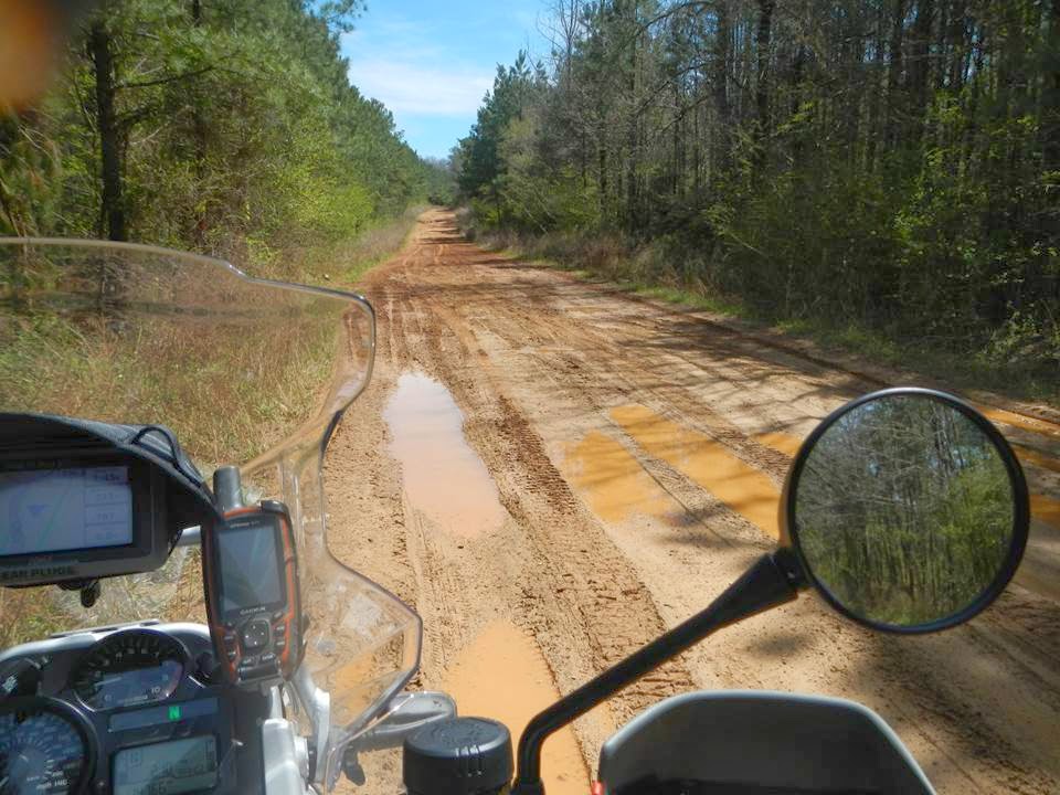
From the end of the Cheaha Parkway into Roanoke, it is a patchwork combination of short dirt and un-improved gravel roads through some poor areas. (Think: third world country) Some sections are MUDDY. Lots of unleashed dogs running around, yard birds, wild turkey, deer and an occasional loose cow or horse. This area reminds me of a combination of the Dukes of Hazard and Africa.
 |
| Figure 9 |
 |
| Figure 10 |
I put in a solid 10 hour day, and feel great. Standing on the pegs in the gravel and the constant navigating keeps me from falling into the zombie like trance I experience sometimes on "boring" slab pavement. Rain is in the forecast tomorrow, so Alabama dirt roads will be slippery. My choices are: 1) continue on the route in mud, 2) take pavement on the next section to Florida, or 3) turn back and head for home, riding out of the wet weather and get back at a reasonable time.
 |
| Figure 11 |
Sunday 4/6/14
I wake to steady rain with a forecast for 100% heavy rain all day in
the area I plan to ride. I opt for #3 because: I am alone, did not pay and entry fee to do this and have nothing to prove other than to have a safe, enjoyable trip. Riding muddy, un-improved dirt and gravel roads on a 600lb Adventure Motorcycle
is not a wise thing to do alone, or with anyone else. I will be back.
With a full tank of gas, I set to GPS to "Go Home" and head North, ending up on I-85 and ride through downtown Atlanta, in light Sunday traffic - what a contrast.
With a full tank of gas, I set to GPS to "Go Home" and head North, ending up on I-85 and ride through downtown Atlanta, in light Sunday traffic - what a contrast.


